The family’s roadworks investigation
Lethal road works
The family’s description and questions
Factual record. No finding of causation or responsibility is made here.
The bank and road edge
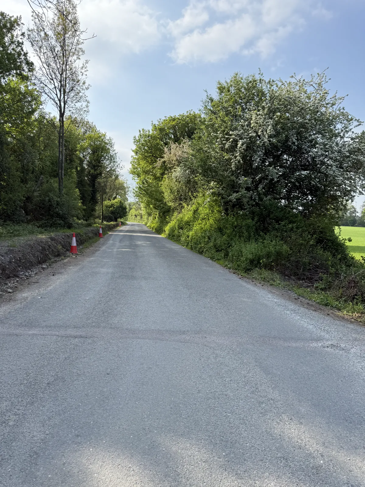
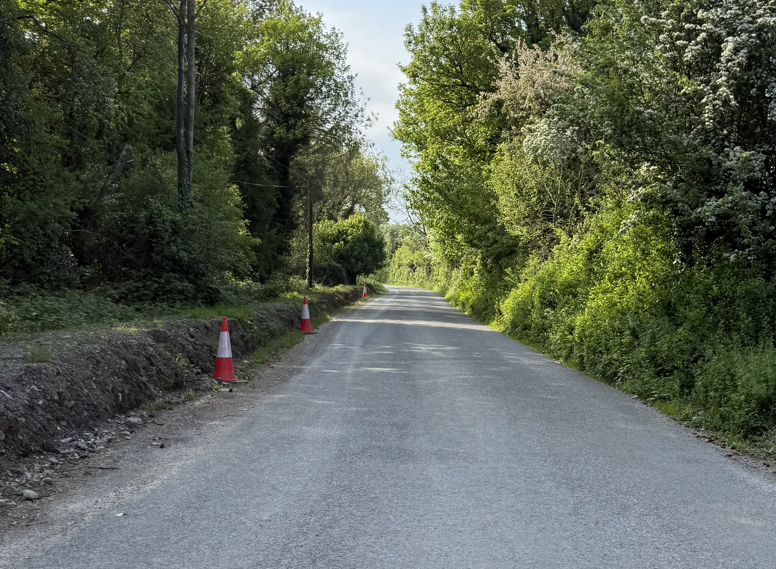
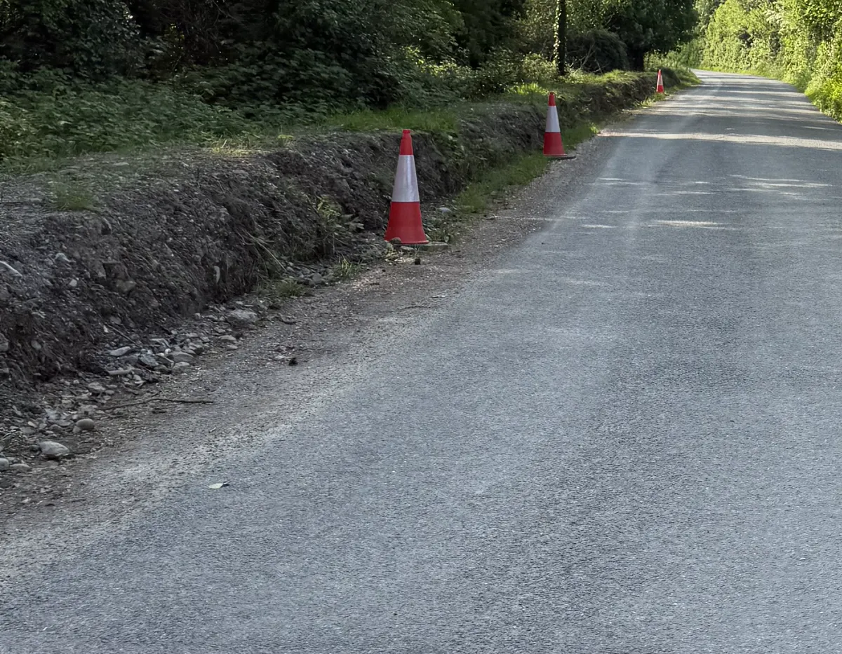
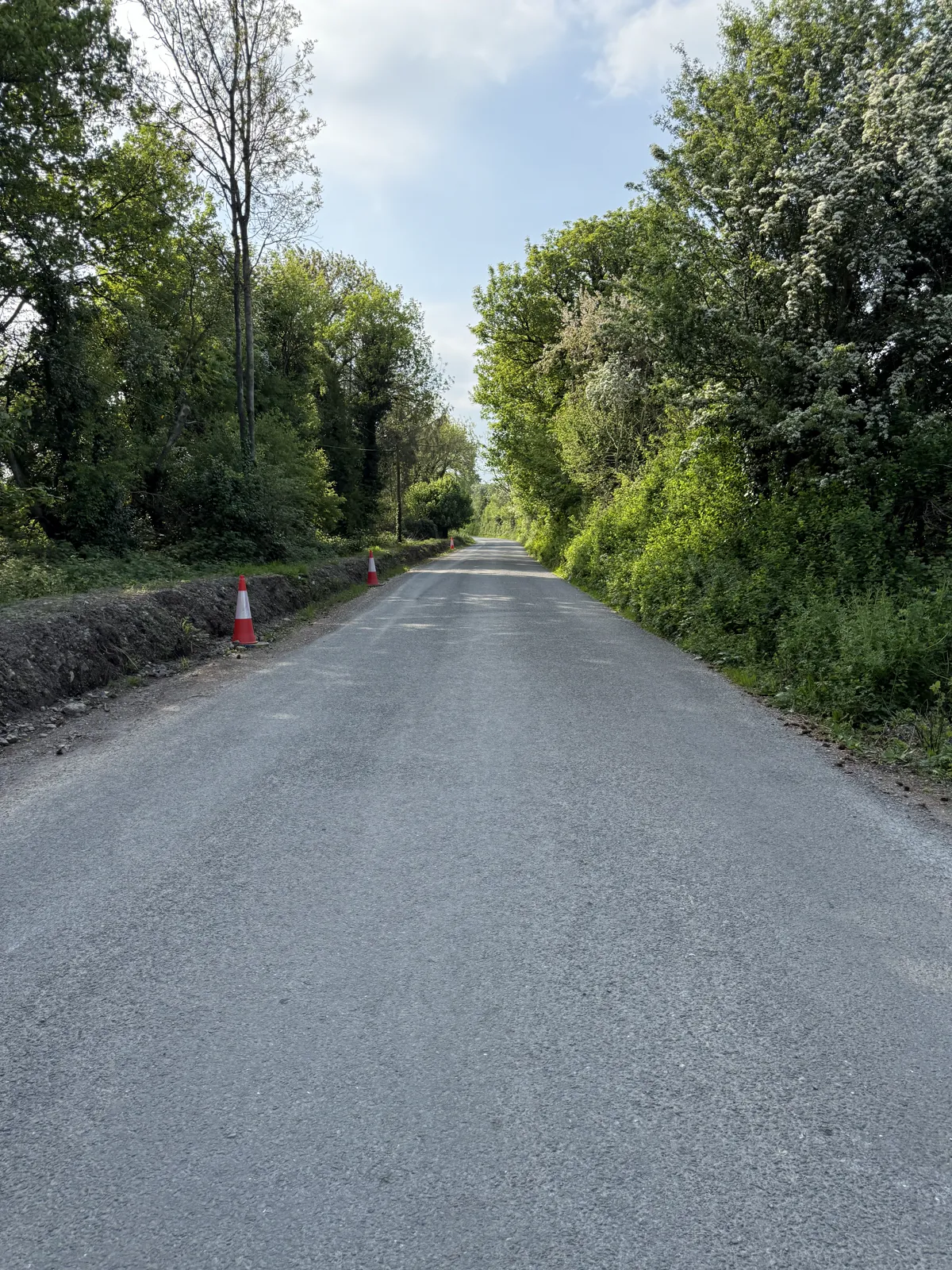
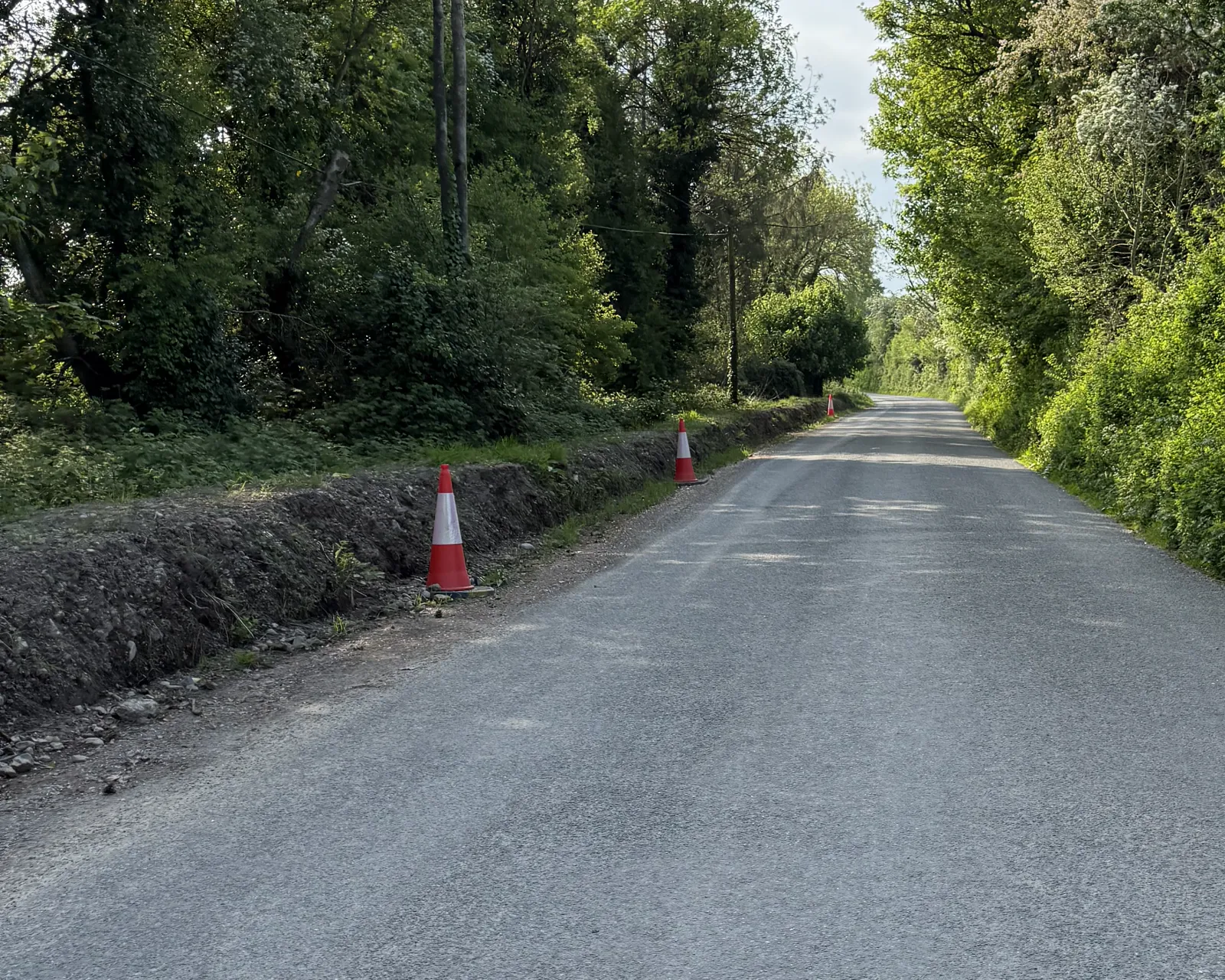
The 1 May photographs matter because they preserve a later view of the road edge. They do not, by themselves, tell us when the bank was cut or what happened on the collision night.
A later view
The family photograph set shows an exposed bank beside the approach, a visible drainage or pipe feature and the road edge in the condition recorded on 1 May 2025. The images should be read with their verified subject, location and original metadata, not by filename alone.
That later view is useful comparison evidence. It can be placed beside the July 2024 imagery and the formal road records, but it cannot silently become a dated construction certificate.
The grass question
The family estimates that the visible regrowth may represent approximately five days of grass growth. That is a family estimate about what the regrowth looked like, not a claim that the photographs were taken five days after the crash. The calendar interval from 24 April to 1 May is seven days.
No botanical method, species identification, baseline photograph, measured growth rate or site-specific model is held here. The estimate therefore remains inconclusive. It may justify asking for dated works records; it cannot date the works on its own.
Safe reading
The careful public description is that the photographs show the bank and drainage features on 1 May, and that the family reads the regrowth as a reason to investigate an earlier disturbance. Whether that disturbance pre-dated 24 April remains an evidence question.
A useful comparison should preserve the same camera direction, fixed landmarks and original file metadata. It should not infer trench depth, soil composition, pipe age or road contamination from colour or shape alone. Those details belong to the dated project and scene records still being sought.
The page therefore keeps the visual evidence valuable without asking it to answer a question it cannot answer. A later image can show a later condition clearly while the work date remains open.
Scroll horizontally to read this table.
| Work element | How a controlled operation should be managed | What the available records and images can and cannot establish | Records to review |
|---|---|---|---|
| Bank face and temporary stability | Set out the approved limits and temporary bank geometry; use the designed batter, bench, toe/crest treatment or temporary protection; inspect changes in ground and weather conditions. | The later images show an exposed-looking bank surface and loose material in the photographed view. They do not establish angle, soil classification, stability, duration, design or whether the condition was unsafe. | Approved drawings/cross-sections; method statement and risk assessment; competent-person or geotechnical assessment; dated site diary and before/during/after photographs. |
| Runoff from the bank | Map clean-water diversion, dirty-water interception, settlement/filtering and the stable outfall. Keep the live lane and adjacent property protected from uncontrolled flow and repair controls when the plan requires it. | Rain can mobilise exposed material in general, but the held rainfall and photographs do not prove that soil reached the carriageway, when it moved, or what route it took. | Drainage sketch and levels; outfall ownership; rainfall-trigger entries; inspection and corrective-action sheets; inlet/outfall photographs; complaints or incident log. |
| Spoil and loose material | Define where excavated material is stored or removed, keep spoil clear of traffic and drainage paths, and record end-of-shift housekeeping and any weather response. | Material visible near a road edge is an observation about that image, not proof of its source, quantity, duration, contamination, movement or effect on vehicle grip. | Excavation and disposal records; delivery/removal tickets; daily diary; housekeeping checklist; time-stamped photographs; handback record. |
| Erosion and sediment control | Cover, stabilise or otherwise control exposed earth while open; protect the toe and outfall; inspect after the work plan's weather/site trigger and document repair. | A later bare or vegetated appearance cannot show whether controls existed earlier, whether a face was unfinished, or whether erosion occurred. | Temporary-works design; erosion/silt-control schedule; material delivery records; inspection logs; weather and repair entries; completion photographs. |
| Road-edge and overlay interface | Survey the existing edge, record any reseal or verge interface, reset drainage inlets where the approved scope requires it, and confirm the final edge is stable and maintainable. | An apparent boundary between seal and earth in a photograph does not identify the scheme, date, specification, or whether an inlet was included in the same job. | Road-management work order; chainage and drawings; resurfacing/overlay records; inlet inspection; as-built or handback record. |
| End-of-day condition | Reduce the exposed footprint; remove loose spoil from the route; secure the bank and drainage; record who inspected the site and what remained for the next shift. | An image taken in daylight cannot prove the overnight arrangement, the inspection frequency or the absence of controls outside the frame. | Shift diary; unattended-site checklist; supervisor designation; time-stamped approach photographs; callout and defect close-out log. |
| Engineer and site-management decisions | The appointed competent role should sign design/temporary-work hold points, record deviations and weather decisions, issue corrective instructions and verify close-out within the actual contract and appointment. | The held material does not establish who made the relevant design, inspection or handback decisions. | Appointment and delegated authority; design checks; hold-point releases; non-conformance/instruction records; change control; handover and maintenance plan. |
Factual record. No finding of causation or responsibility is made here.