What happened
The road that night
In sequence, in plain language — from the council's own records, and from what the family found at the scene. Six things came together at one point on one bend.
Illustrative, drawn to the recorded measurements. From the council's own inspection record (21 Jan 2025) and the forensic findings.
The evidence, in one place
What Bronagh faced
Not a theory — photographs. The road, the wall, and the warning that never came, in the council’s own records and the family’s own pictures of the exact spot on the bridge.
The council’s own inspection recorded the capping “partly removed” and a 5-metre length of wall “collapsed.” Its own bridge record answers the question “Is Signage Present?” in a single word — “No.”
1 · The road — the water, and works left unfinished
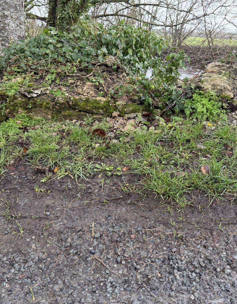
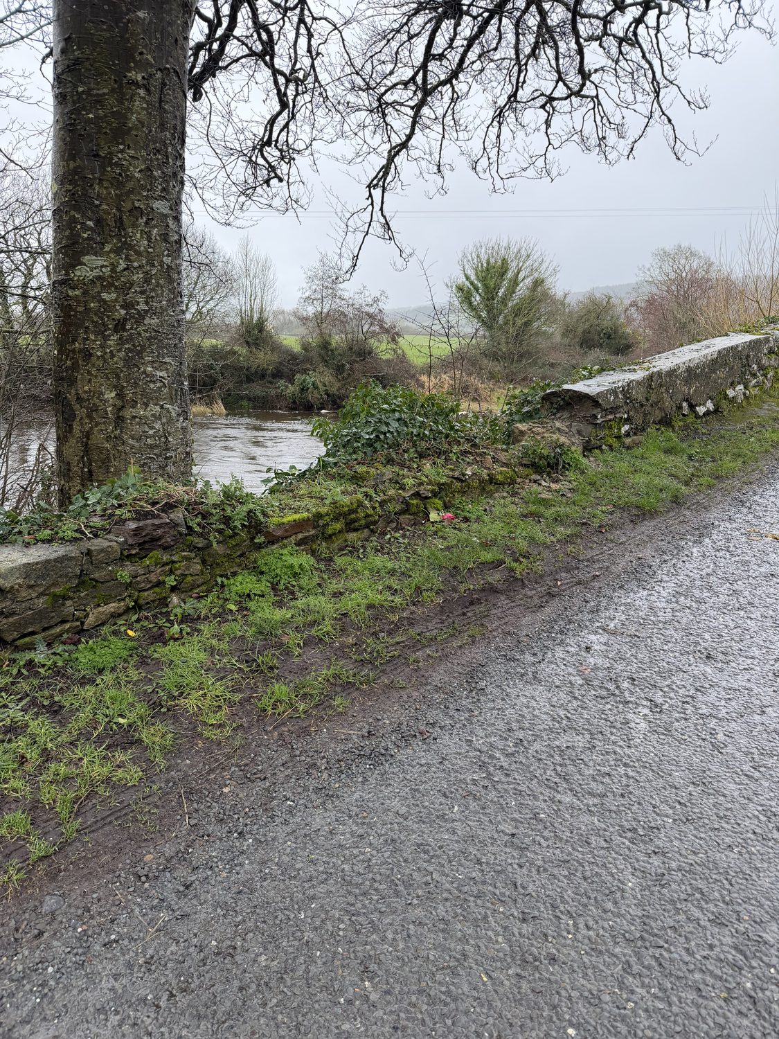
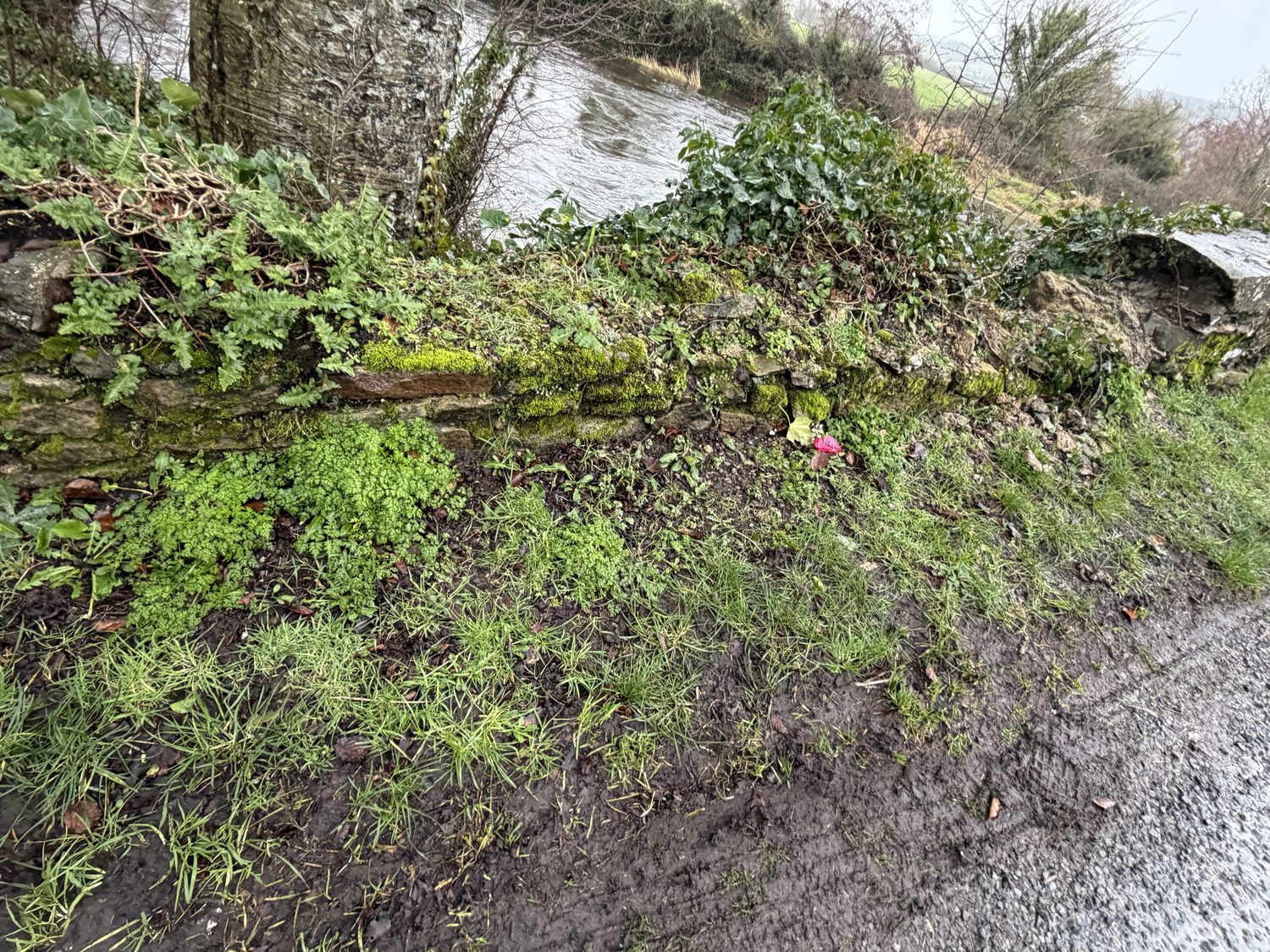
Photographs taken on 1 May 2025, GPS-confirmed at the bridge: a freshly-cut verge and disturbed ground, with clay and loose stones along the edge of the carriageway. The family’s position is that groundworks affecting drainage were carried out around the time of the crash; the council’s account is “routine verge-inlet cleaning.” The dated, located images are placed against that account.
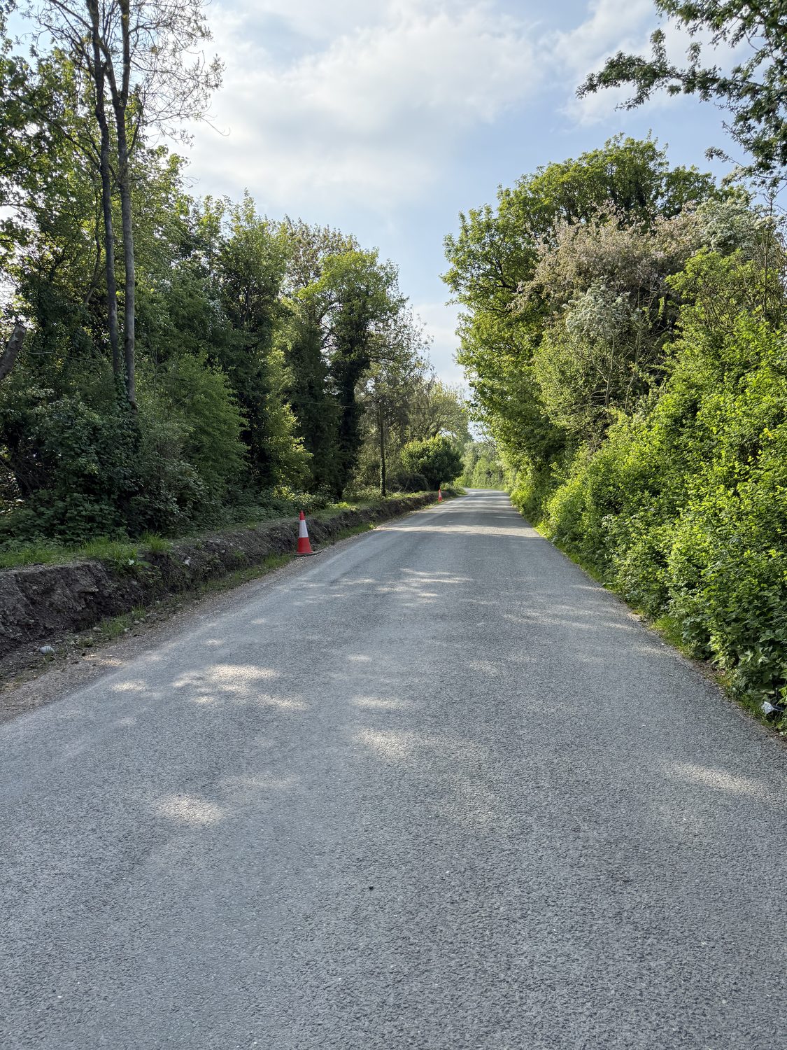
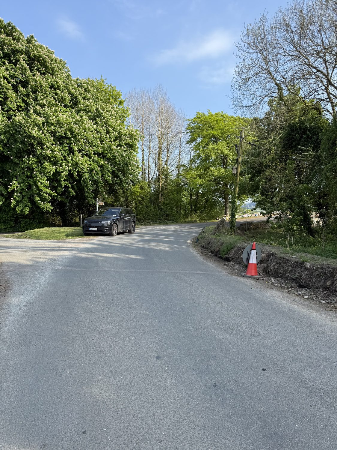
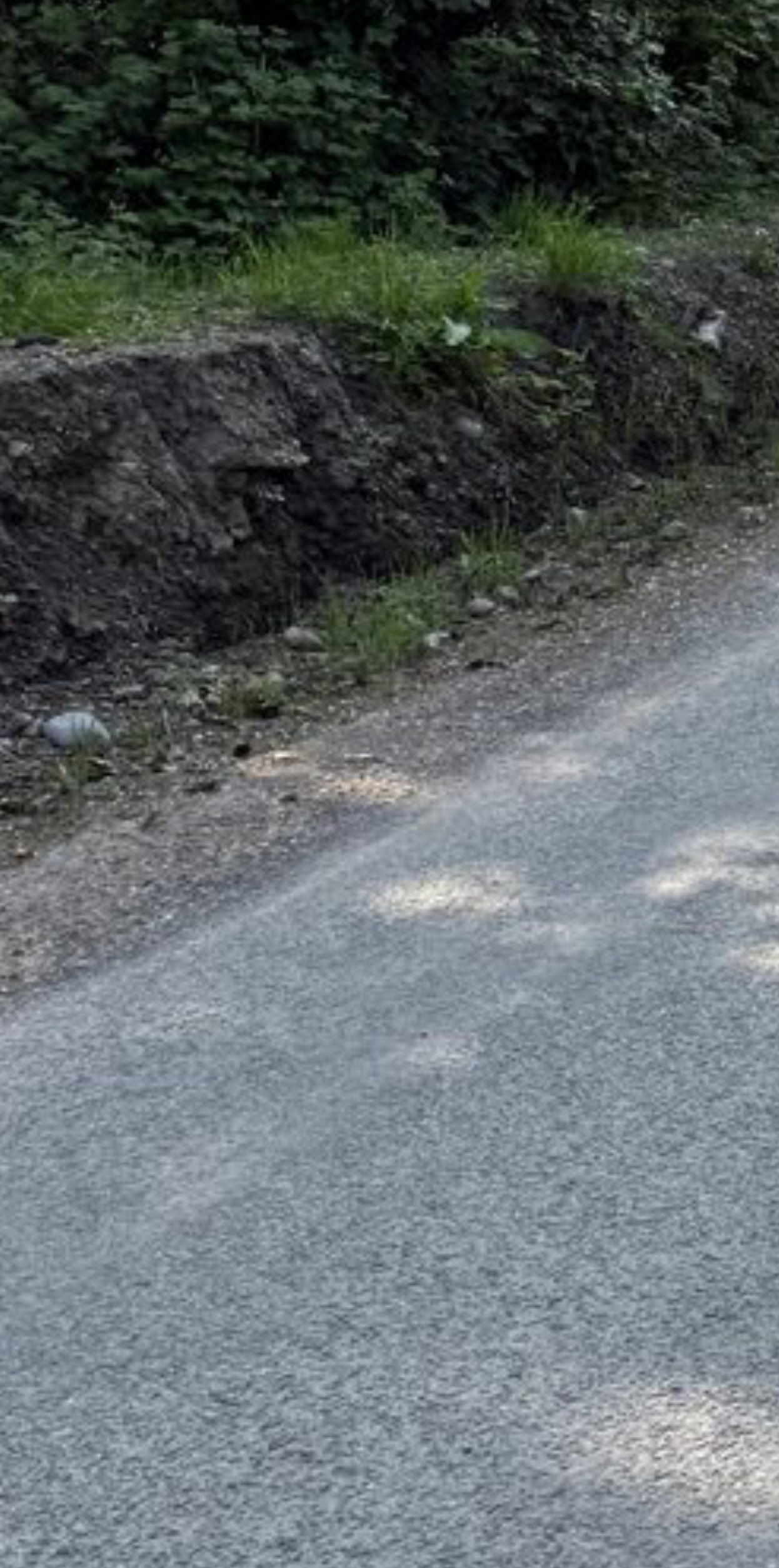
2 · The wall — the capping removed, a ramp not a barrier
The parapet is the wall meant to keep a vehicle on the bridge. On 21 January 2025 the council’s own inspection recorded that “the capping of the downstream wall has been partly removed” and that “a 5m long length of wall has collapsed.” Where it should have stood at 1.25m it stood at 0.23m — and the grass had grown over what was left.
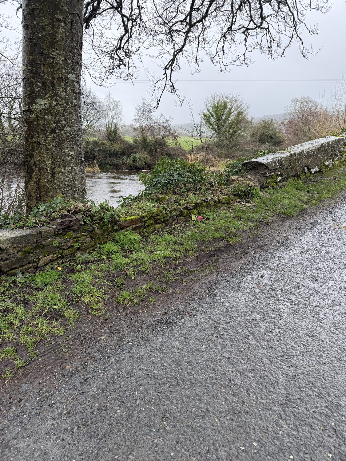
3 · The warning that never came
On the approach to a blind 90-degree bend and a narrow bridge, there was not one warning sign. The council’s own bridge record answers “Is Signage Present?” with a single word: “No.”
A photograph of the exact approach, verified as this bridge, is being sourced before it is shown here.
Sources: Tipperary County Council bridge inspection TY-L3151-B-010 — 20 June 2024 (“Warning”) and 21 January 2025 (“Significant Damage”); Denis Wood Associates technical report, surveyed 22 May 2025; family photographs, GPS-confirmed at the bridge. A factual account from documents held on file, presented so the public can see the state of the road and bridge. It does not determine legal liability.
- A blind bend, in the dark and heavy rain. At 22:01 on 24 April 2025, in dark, heavy rain, Bronagh's 2021 Ford Fiesta came to Killardry Bridge — a blind right-hand bend at a junction, straight onto an 1800s humpback bridge just 4.8m wide, set at a 90-degree skew to the road. TCC 2014 inventory (Approach Skew 90°; carriageway 4.80m).
- Water lying on the road. The water was not being carried off the road at the bend. The council's own inspection recorded the bridge being undermined — a "major diagonal crack … which should be underpinned and repointed as soon as possible," trees growing into the masonry, and soft verges. TCC engineering inspection, 21 Jan 2025; and the family's account of the scene.
- Clay and loose stones washed across the carriageway. With the water came clay and stones across the road surface — at the exact point where a driver must hold the bend. The family's account of the road on the night. To be evidenced
- No sign. Nothing to slow you down. There was not one advance warning sign on the approach — the council's own bridge record answers "Is Signage Present?" with a single word: "No." The limit was 60kph — cut from 80 km/h on 7 February 2025 — eleven weeks before — on a bend that cannot be safely driven above 46kph in the wet. TCC PMS record; DWA forensic findings.
- No wall on the bridge. Where the parapet should have stood at 1.25m, it stood at 0.23m — the capping stones "partly removed" and a 5-metre length collapsed. At the point of impact there was, in effect, no wall. TCC engineering inspection, 21 Jan 2025.
- The grass made it a ramp. Grass and vegetation had grown over the low remnant of the wall — turning the one thing that should have stopped the car into a ramp. Travelling at 30–35kph and within the limit, the car rode up it and over — a drop of about 4.3 metres into the River Aherlow, with no vehicle restraint of any kind. The Garda review of the camera footage found she was within the limit and did not swerve. DWA forensic findings; Garda review.
Source: TCC 2014 inventory (Approach Skew 2: 90.00 deg; carriageway 4.80m); DWA forensic findings (bend radius, speeds) — findings usable, report privileged and never published
The bridge appears in public records under several spellings — Killardry, Killaldriffe, Killadriffe and Kilaldry — all the same 1800s humpback bridge over the River Aherlow at Kilmoyler, near Cahir, Co. Tipperary.
The POV drive
A silent, unnarrated drive of the approach at the posted 60kph — daylight and wet-conditions versions — is being prepared. It makes the point without a word. In preparation
The numbers behind each of these →
Last updated 2026-09-07. This is a living record — findings are added as dated entries and prior versions remain visible.